If you are looking for a modern, precise and efficient way of capturing an entire built environment, then you and your project need point cloud modelling. More cost-effective than traditional 3D models and using a lot less storage space and processing power, point cloud modelling is rapidly becoming the desired surveying and visualising method of many architects. Read on to find out what point cloud modelling is, and what the advantages of point cloud modelling are.
Laser scanning for higher precision

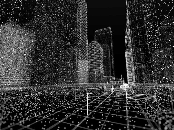
The technology of point cloud modelling is fairly simple. 3D laser scanning, which was originally used to find submarines, is now widely available for commercial use. By setting up several scanners in various locations, a sweeping beam of lasers can be used to accurately scan and map an area. The light distance between the scanner and the object or material is recorded in X, Y and Z coordinates, making a ‘point’.
At Spectrum, we are a specialised surveying company. That is why we use laser scanners that can capture up to a million unique points a second, so a vast amount of accurate data is recorded. Once we have completed the scans, your raw data needs to be calibrated in a software program. Due to the large amount of data collected by the scanners, this can be quite tricky and it is recommended that you hire an expert point cloud modelling firm to do this.
Once your data is calibrated, it can be imported into any Building Information Modelling (BIM) program, where it can then be used to visualise your building area, the building itself, or any other object or model you need to be visualised.
Accurate data for your entire project
One of the greatest benefits of point cloud modelling is that it allows architects, designers, construction managers and contractors to know exactly what is going on for the entire duration of the project. Using point cloud modelling with your BIM project allows better access and understanding of the project and, therefore, better decisions can be made.
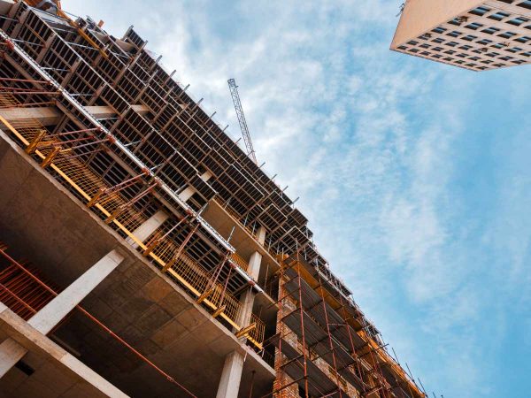
Pre-construction laser scans allow you to see what type of terrain and site you’ll be working with, and can even map unexpected surprised like underground tunnels, inaccessible areas and possible loose, dangerous terrain. During construction, point cloud modelling allows you to continuously do quality control and check the progress of your project, as well as creating floor plans and a full record scan.
Once your project is completed, a laser scan record can be an invaluable resource during the handover process. Point cloud modelling is also helpful for facility and building managers who require accurate plans of the building, as well as those looking to renovate or demolish the building in the future.
Saves your project time and money

Laser scanning and point cloud modelling is a major time and money saver for your project. Traditional surveying and modelling techniques are far more human resources heavy and can take a significant amount of time, especially if you have complex data requirements.
Laser point cloud modelling can usually be completed in one site visit and can be shared with the project team in a few hours. Point cloud modelling also is more accurate than traditional 3D models, meaning you are delivering a more precise model and reduces the time needed for on-site modification. This allows designers, construction managers and engineers to get on with the project.
Do you want to save time and money on your construction work? Want accurate and precise data for the entire length of your project? Contact Spectrum today and find out more about our point cloud modelling process.